Monday – Oct 2, 2017 Llaqtapata to
Llulluchapampa
Inca Trail Day 2
At 5am, I woke up and there was no putting off
going to the bathroom any longer. The tarantula was still there, but once again
disappeared into the door framing when I turned on the light.
The official wake-up call was at 5:30am, when the
porters came around with tea and hot water for washing. Russell opted for
another shower, and I just washed my face with the water provided by the
porters. I was concerned about the tea, and sure enough I managed to spill mine
in the tent on my sleeping bag and mat. It took me 5 minutes to mop that up and
I got tea all over my wash-cloth. This necessitated another trip to the
bathroom to wash it out.
I ran into Carlos at the bathroom and told him
about the tarantula. I made the comment mainly
because he seemed interested in tarantulas, pointing out the one we found on
the trail yesterday. He said tarantulas
don’t usually climb, so it probably wasn’t a tarantula. I thought he must be making
that up to calm me down and I didn’t say anything, but later I wished I had. I
hope he didn’t think I was dissatisfied with the condition of the washroom. I do have a phobia about spiders, but comfort
stations at campgrounds in Canada are full of them, so I’m pretty much
de-sensitized to it. The first thing I do in any camp bathroom is look for
spiders and then keep an eye on the ones I know about. Having toilet and shower
facilities on the Inca Trail in Peru was a completely unexpected luxury and I
was very pleased about it. The spider was just an unavoidable part of the
package deal. At least the tarantula was very shy and hid when I went in.
It was another beautiful, sunny day, and the
sun rose right over the ruins at Llactapata.
 Breakfast was at 6am, and we were to leave at
7am. There was fruit and granola (my favorite), among other things for
breakfast, and I asked Carlos if there was any yogurt. He said there should have been, but the jar
broke.
Breakfast was at 6am, and we were to leave at
7am. There was fruit and granola (my favorite), among other things for
breakfast, and I asked Carlos if there was any yogurt. He said there should have been, but the jar
broke.

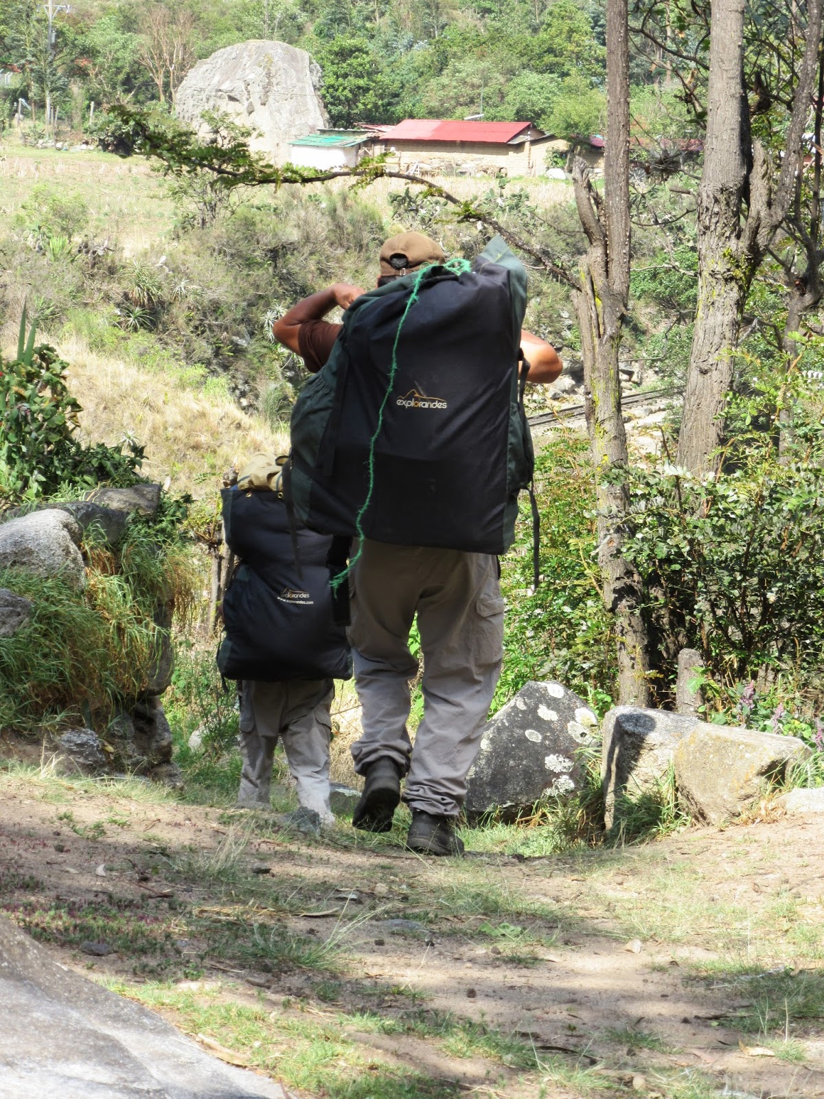
We formally met the porters and had introductions
after breakfast. Almost all of them were from Cacchicata in Peru. Historically,
the area around their mountain village was dedicated to extracting and carving
the stones that were used in construction around Ollantaytambo. It is located
nine miles from Ollantaytambo and has three groups of quarries: Molle Pucro;
Sirkusirkuyoc, which was the largest of the three and showed evidence of having
been in full operation when the Spaniards came to this area; and Cacchicata or
Kantirayoq, where other kinds of extraction of minerals and precious stones was
practiced. On our Sacred Valley tour, we saw first-hand the incredible work
done moving the giant stones. This was evidenced by "Tired Stones" in
the area, which were massive stones that were being moved from the quarries to build
the enclosures, but never made it.
Our porters were subsistence farmers,
supplementing their livelihood with some cash. The oldest was 68, and he was
responsible for the toilet tent. The youngest was 24, and he was the head
porter. The rest were in their 40’s, 50’s and 60’s. Russell was 65, I was 64,
Mike was 63, Sue-Anne was 59, and our guide, Carlos, was 27.

 We each got a 2-liter portion of water, an
orange and a chocolate bar and set off at about 7:30am. We were a bit late
leaving.
We each got a 2-liter portion of water, an
orange and a chocolate bar and set off at about 7:30am. We were a bit late
leaving.

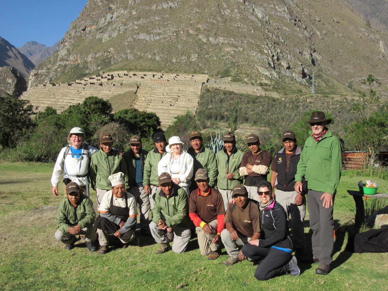
Llactapata,
also called Patallacta is one of the largest settlements in the region. The
site, on a crescent-shaped bluff where the Cusichaca joins the Urubamba, is
laid out in a typical Inca fashion and dates from the mid-15th
century. There are 116 buildings and five baths laid out in a regular pattern.
A canal feeds the main baths but appears to have fallen into disuse shortly
after the invasion of the Spanish conquistadors, implying that the site was
abandoned around 1540.

 Extensive terraces surround the buildings,
suggesting that the site used to be primarily an agricultural station. The site
probably also had a strategic function as it sits at the junction of a number
of Inca paths, and was ideally placed to regulate traffic and monitor who was
moving where.
Extensive terraces surround the buildings,
suggesting that the site used to be primarily an agricultural station. The site
probably also had a strategic function as it sits at the junction of a number
of Inca paths, and was ideally placed to regulate traffic and monitor who was
moving where.


From this point there were good views back down
the Cusichaca valley to Mt. Veronica, which is visible as a pyramid in the
middle of the valley.


We continued our journey up the narrow
Cusichaca Valley passing houses inhabited by settlers. 2km after Hatun Chaca we
crossed another bridge, this time over the Llulluchayoc river, a tributary of the Cusichaca. The bridge was at the outskirts of the Andean
community of Huayllabamba. Huayllabamba,
a sprawling place built above Inca terraces, is the largest village on the
trail and it’s the last place where you can buy basic food supplies. It was a
warm day, already at 25ºC according to our hiking themometers, so it was really
nice to be able to buy an ice-cold Gatorade and take another short break
admiring the scenery (sorry – no photos from here).
At the top of the village was a Warden’s Office
where we had to register, and porters have their loads checked and weighed
before they can progress. The trekking company incurs a very heavy fine or can
lose their license if one of their porters is caught carrying more than 20
kilos.
When we set off, Carlos told us that it was
going to be very steep from here on to our camp tonight. We were at 2,590m this
morning at Chamana Camp, Huayllabamba is at 2,946m (not 3,100 as the sign said),
and our campsite tonight is at 3,840m. So not counting any ups and downs, we
had already climbed 356 meters, and had about 900 meters left to climb. The
altitude was getting higher and higher, so the air was getting thinner.


We walked alongside the Quebrada river, occasionally
close to the water and at other times high above it, on a series of steep
steps. Along this stretch we passed a llama grazing in the forest.

 We passed some more locals with horses carrying
supplies, taking a break along this steep section. I was pretty exhausted at
this point, and would have preferred if the locals hadn’t been there watching
the ‘gringo’ struggling up the mountain. Although, they were all sitting there,
so they had probably all been struggling up the mountain too.
We passed some more locals with horses carrying
supplies, taking a break along this steep section. I was pretty exhausted at
this point, and would have preferred if the locals hadn’t been there watching
the ‘gringo’ struggling up the mountain. Although, they were all sitting there,
so they had probably all been struggling up the mountain too.


Sue-Anne and I asked Carlos how much further it
was to get to our campsite, and he said about another hour. I told Sue-Anne
that if this was going to go on for another hour, I was really going to have to
pace myself, and started going even slower than the crawl I had been moving at.
Sue-Anne and Russell, at different times but later in the trek, told me they had
doubts whether they would be able to make it all the way to the campground that
day.
After about another 10 grueling minutes, we
reached a point above the cloud forest, and I saw the most beautiful sight. I’m
not talking about the view of Mt. Huayanay, which was breathtaking, but three
blue Eureka tents. Incredulous, I asked Carlos if this was our camp, and he
said yes. I was never so relieved in my life. That Carlos can be quite the practical
joker. We got there at 3:10pm.
Our camp, Llulluchapampa had running water, a
toilet block set on the top tier of terraces, and exceptional views down the
valley.


I realized at that moment how accommodating the
toilet tent was, and developed a new appreciation for that facility being
provided for us on the trek. Back at our tent, I also figured out how I could
very adequately and satisfactorily have a complete bath using the two bowls of
warm water the porters provided, supplemented with a few of the wet wipes we
had brought. I used one bowl as the washing water and the other bowl as the
rinse water. Since Russell and I had to share the two bowls and the intent was
probably that one was for him and one was for me, I instructed him on the
designation of the two bowls. He wasn’t really into the whole bath in a bowl
concept, and never really used the water for more than to wash his face,
leaving me with basically both bowls to myself.
We gathered for appetizers in the dining tent,
followed by a lovely four course dinner. Carlos explained that most of the
porters would be leaving us after breakfast on the fourth day, and that would
be when we would distribute the tips. We talked a bit about the tips and
decided we would have a meeting before dinner tomorrow to sort it all out. We
were all excited and a bit apprehensive about making the trek over Dead Woman’s
Pass tomorrow. It was going to be our longest and hardest day so wake-up call
was at 5am and we were to leave by 6am.
Llulluchapampa campsite was exposed and apparently
it can get very cold at night and the ground becomes boggy after torrential
rain. But, it was perfect conditions when we were there, and it was a beautiful
moonlit night. We were both exhausted and fell asleep very quickly.
We both got up during the night, and found our
headlamps came in very handy finding our way to the toilet tent in the dark. Having
close to a full moon was an added bonus.
 Day 2 Distance: 9km; Ascent: 1250m;
Descent: 100 m; Elapsed time 7.5hr (7:30am to 3:11pm); Moving Time: 5.5hr.
Day 2 Distance: 9km; Ascent: 1250m;
Descent: 100 m; Elapsed time 7.5hr (7:30am to 3:11pm); Moving Time: 5.5hr.